THE VTXL 5 DAY CHALLENGE!
Join 2ndgo on our next mission!
July 11th – 15th

THE RIDE DETAILS
Join me this coming July 11th – 15th 2024!

– 5 DAYS –
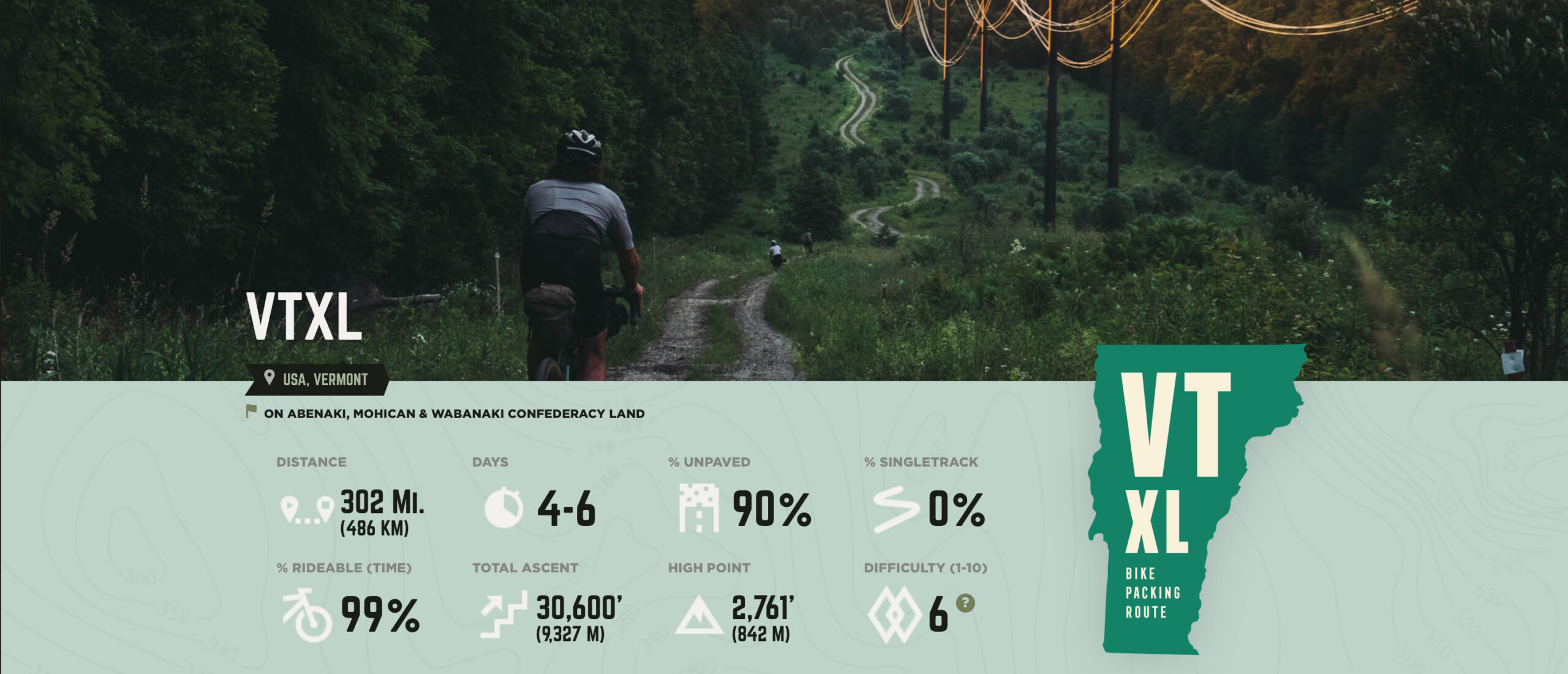
– 302Mi (486KM) –
– TOTAL ASCENT 30,600′ (9,327M) –
– 90% unpaved –
– THE MOST EPIC RIDE –
Over 300 miles awaits me as I head out on two wheels this summer.
I will be making my way along the best gravel roads and high category paths in the state of Vermont starting at the boarder of Canada. Cycling roughly 60+ mi per day (in total 302 Miles).
Taking on this challenge will not only push my mental and physical limits all in an effort to raise funds to aid 2NDGO and their continued programing.
I hope that with support from you and others my goal of reaching $5000.00 will become a reality!
Wondering how you can support me on while i am on this ride?
ONE-TIME DONATION
Make a one-time donation in the amount that suits you best.
Any amount provided supports this mission and helps 2NDGO continue with our journey.
Mileage DONATION
Consider sponsoring my ride by making a donation based on every mile I ride.
You choose a set monetary amount per mile and then make a one time donation for the total amount.
example: $0.25 per mile for 302Mi = $75.50 Total donation.
EXPLANATION OF DIFFICULTY
The majority of the VTXL is on smooth and well-maintained dirt and gravel roads that typically pass close to towns, allowing an easy resupply of provisions. There are, however, a dozen rugged and rocky Class IV sections (“Class IV” is a Vermont road designation that indicates a public right of way but where there is no maintenance given). These sections vary in length but are usually under 2 miles/4 kilometers. They require some off-road skill to ride and might involve a few minutes of “hike-a-bike.” The main challenge of the route is the substantial climbing. In light of the occasional Class IV roads and climbing we have assigned a difficulty rating of 6 on the assumption of five days of riding.
Follow the ride
Below is a list of stops and sites I may use along the route each day.
each day’s ride is based on a cycling pace between 15 mph and 18 mph. this means each day’s ride will vary for time in the saddle. Projections show between 5.5 hours up to 7 hours. (these times also have short stops and lunch breaks included in order to let me fill up on supplies as needed). LEAVING each site early will allow for adjustments to be made for detours and additional rest time once I reach each new camp location
DAY 1: Heading out from the town of Canaan, VT will see the first leg of this incredible journey!
Total mileage for day 1 : 60.8 mi
Campsite for the night will be: Burke Mountain Campground
Site can be seen HERE
There is a nice market a short walk or spin down the road to pick up supplies for DAY 2 as well as dinner needs for the first night.
DAY 2: Continuing on, I depart the first camp location and head out for short but enjoyable ride. Do not let the 40 mi fool you! Some tough climbs are coming and the following days ride is a big push!
Total mileage for day 2 : 42 mi
Campsite for the night will be: Pleasant Valley Campgrounds.
Site can be seen HERE
Showers on site are coin use only but will give me an opportunity to freshen up and ready myself for a big push the next day.
Same as day one, there are a number of nearby stores to pick up supplies needed for refueling.
Day 3 will see me move onto the biggest leg of this challenge yet! A solid 65+ mi stretch. I will arrive at one of two locations for the evening.
Total mileage for Day 3: 65+ mi
Campsite options for the night are the following:
Four Springs Farm Campground
Site can be seen HERE.
OR
Amity Pond Natural Area lean-to/shelter
(it’s hidden away in the sticks but one of these two little gems can be found using the map HERE)
There are plenty of fill up locations in the area and stores for re-supply.
After a solid 65 miler, we will arrive at our last campsite. The cool flowing river that runs along side it will be perfect for a dip to relax and recharge before a nice camp fire!
Total mileage for Day 4: 65.4 mi
Campsite for the night will be: Winehal Brook Campgrounds
It can be seen HERE.
A short walk/ spin down the road will find you in Rawsonville that offers a number of fantastic restaurants to fill up on fuel for the last days ride!
After fueling up on breakfast from the local area Diner (I won’t forget to pack a few goodies for the road) My last push of 64 miles will seem like nothing after the previous 4 days.
I will be ending our journey right on the VT, MA and NY state lines. Here I plan to rest for a few moments before making the drive home as I reflect on how much pain and burn I felt during the 302miles and 30,000 ft elevation of climb I just completed.
SUGGESTIONS for Packing and items you should bring.
Bike items
- 1: BIKE
- 2: HELMET
- 3: BIKEPACKING PACKS (seat pack, handlebar pack, frame pack,
- 4: HEADLIGHT
- 5: TAIL LIGHT
- 6: LIGHTWEIGHT LOCK (optional)
Must have camp itemS
- 1: TENT
- 2: SLEEPING PAD
- 3: SLEEPING BAG
- 4: PILLOW
- 5:GUYLINES & STAKES
- 6: HAMMOCK (optional)
**PLEASE READ FULLY**
Terms of Use: As with any of 2NDGO events. Should you choose to take part and cycle this route, you do so at your own risk. Prior to setting out check current local weather, conditions, and land/road closures. While riding, obey all public and private land use restrictions and rules, carry proper safety and navigational equipment, and of course, follow the #leavenotrace guidelines. The information found herein is simply a planning resource/ guide to be used as a point of inspiration in conjunction with your own due-diligence. In spite of the fact that this route, associated GPS track (GPX and maps), and all route guidelines were prepared under diligent research by the specified contributor and/or contributors from www.bikepacking.com , the accuracy of such and judgement of the author is not guaranteed. 2NDGO.ORG and/or BIKEPACKING.com LLC, its partners, associates, and contributors are in no way liable for personal injury, damage to personal property, or any other such situation that might happen to individual riders cycling or following this route or taking part in this mission.
